The super typhoon Sinlaku with winds blowing up to 150 mph (Category 4) hit the U.S. territories of Saipan and Tinian, Northern Mariana Islands, at 10:15 p.m. local time on April 13, 2026 (8:15 a.m. ET).
Typhoon Sinlaku brought severe winds, rainfall, and flooding to the Pacific islands, which are inhabited by roughly 50,000 people.
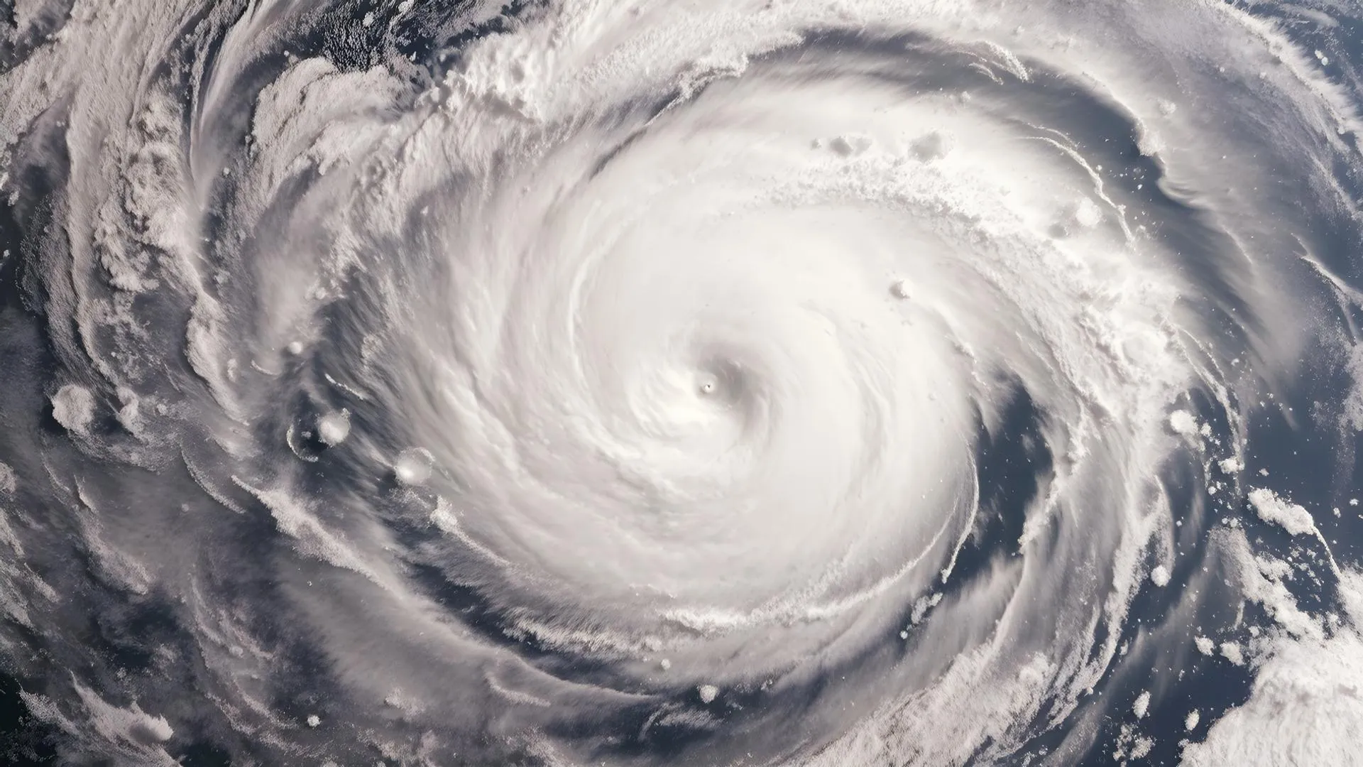
Before making landfall, the tropical storm became the year's most intense in 2026 but slightly weakened afterward, thereby avoiding Guam and leaving behind blackouts, torn roofs, and debris while issuing warnings for flash floods until April 15.
Super Typhoon Sinlaku Slams U.S. Pacific Islands With Powerful Winds and Heavy Rain
The eyewall of Sinlaku made landfall, causing tin roofs to be ripped from houses and debris flying around in the streets.
As the constant rain caused flooding in low-lying areas, people, such as Hunter, a local veteran who took refuge in concrete buildings, found themselves fighting the leaking roof from the rain that found its way into all corners even when the windows were boarded up.
The National Weather Service reported sustained winds of 145-150 mph in Guam before downgrading it from the super typhoon category.
Shelters were encouraged to prepare to withstand the storm, with the hotels in Saipan, known for snorkeling and golf, being closed in preparation for evacuations.
Check: Oklahoma School Shooting Averted After Principal Tackles Shooter
Sinlaku Northern Marianas Impacts and Damage
The flash floods continue until Wednesday in Saipan, the capital city that is famous for tourism, and in Tinian due to heavy rains that have caused road flooding and forcing rescue crews to wade through overflowing rivers.
Initial damage to structures has been reported, but so far no casualties due to timely warnings by meteorologists such as Joshua Schank who predicted the path of the cyclone, which passed very close to the islands.
Assistance is arriving from the United States mainland to restore electricity and clear up debris, while flight operations at local airports remain suspended indefinitely.
Read: Quote of the Day by Walt Disney
Saipan Tinian Typhoon Path and Warnings
Forecasters expected that the path of Sinlaku would impact the areas of Tinian and Saipan, growing from a tropical depression to a monster storm with peak wind speeds of 175 mph.
The warmth in the Pacific helped to make it grow and become a super typhoon, making it the year’s strongest one.
Fortunately for Guam, Sinlaku took a course northeast, thus avoiding any harm to the island.
Experts point out that such storms tend to increase with climate trends and become weaker after Sinlaku turns. Still, there is always the threat of landslides caused by heavy rainfall in the hills.
Know about: Tornado Warning Issued in Minnesota After Powerful Sighting
The Northern Mariana Islands start to recover from the impact of Sinlaku, rebuilding communities with lessons learned from this storm.