

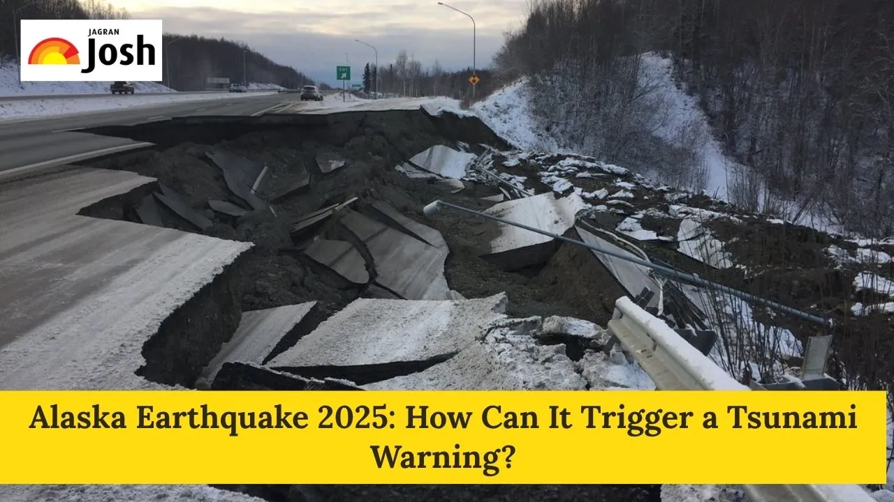
A 7.3-magnitude earthquake occurred off the coast of Alaska on 16 July 2025. The USGS reported that the epicentre of the earthquake was located about 54 miles (87 km) south of the island town of Sand Point and had a depth of 20.1 km. It occurred at around 12:37 p.m. local time (20:37 GMT). It could have caused a tsunami, due to which authorities first issued a tsunami warning. However, they later lowered it to an advisory and finally cancelled it completely.
We got this incredible footage of today's earthquake from a resident in Sand Point, about 50 miles from the epicenter. We are grateful to those who shared their experiences -- it allows others to understand what an earthquake is like, and be better prepared. We are also grateful… pic.twitter.com/5tkqcbgp9Y
— Alaska Earthquake Center (@AKearthquake) July 17, 2025
But this time, the big warning was lowered to a smaller one in about an hour, and then all tsunami alerts were completely called off because the immediate danger had passed.
Through this article, we will understand what happened in Alaska, how it compares to the 1964 Alaska earthquake, where Alaska is geographically located, why Alaska is prone to earthquakes, and what triggers a tsunami warning.
Check Out:How Well Do You Know the Grand Canyon? Check Quiz Questions and Answers with Facts
What Happened in Alaska?

Alaska frequently experiences significant seismic activity, and this often leads to tsunami warnings. For example, a 7.3-magnitude earthquake struck off the coast of Alaska in July 2025, prompting a tsunami warning for a large stretch of the Alaska Peninsula and surrounding areas. While this particular warning was later downgraded and then cancelled as the generated waves were not significant, it highlights the constant threat.
A notable example is the 1964 Prince William Sound Earthquake (magnitude 9.2), which is the second largest recorded and the strongest in North American history. Historically, Alaska has been the site of some of the most powerful earthquakes that have actually triggered a devastating tsunami. The earthquake caused a large-scale tsunami, which destroyed coastal communities in Alaska and caused damage to the American western coast and air, causing significant damage to life.
Where is Alaska Located Geographically?
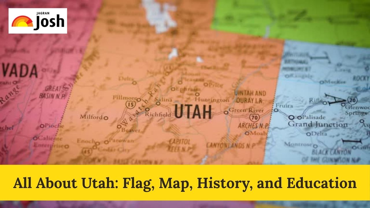
Alaska is the largest U.S. state, which is located in the far northwest of North America. It's separate from the other 48 states. It's bordered by the Arctic Ocean to the north, the Pacific Ocean to the south, Russia and the Bering Sea to the west, and Canada to the east. Alaska features a huge coastline, many islands, vast tundra, and North America's tallest peak, Mount Denali.

Why is Alaska Prone to Earthquakes?
Alaska is highly prone to earthquakes because it sits directly on one of the most seismically active regions on Earth: the Pacific "Ring of Fire". Moreover, Alaska's seismic activity is dominated by the interaction between the Pacific Plate and the North American Plate.
Along the Alaska-Aleutian subduction zone, the Pacific Plate is constantly moving northward and subducting beneath the North American Plate. This process is not smooth, and the plates get locked, which builds up immense stress. When this stress is suddenly released, it causes earthquakes.
Did You Know? Beyond the main subduction zone, numerous active faults crisscross the Alaskan landscape. It includes major strike-slip faults like the Denali Fault, which can also produce powerful earthquakes.
What is the Ring of Fire, and how does it relate to earthquakes?

The Ring of Fire, also known as the Pacific Ring of Fire or Circum-Pacific Belt, is a major area in the basin of the Pacific Ocean where a large number of earthquakes and volcanic eruptions occur. It is a horseshoe-shaped belt approximately 40,000 kilometres (25,000 miles) long.
How it relates to earthquakes:
The Ring of Fire is essentially a series of convergent plate boundaries where several tectonic plates (like the Pacific Plate, Nazca Plate, Juan de Fuca Plate, etc.) are subducting beneath other plates (like the North American Plate, Eurasian Plate, Indo-Australian Plate). These subduction zones are areas where one tectonic plate slides beneath another into the Earth's mantle. This process generates immense friction and stress. When this stress is released, it causes powerful earthquakes.
-
Seismic Activity: About 90% of the world's earthquakes, including the vast majority of the most powerful ones (like megathrust earthquakes), occur along the Ring of Fire. This makes it the most seismically active zone globally.
-
Volcanic Activity: The subduction process also leads to the melting of rock in the mantle, which rises to the surface, forming the chain of active volcanoes that characterize the Ring of Fire.
Alaska's location on the Ring of Fire is the primary reason for its high susceptibility to both earthquakes and volcanic activity.
How Warnings are Issued:
If a potential tsunami-generating earthquake occurs, the centres use sophisticated computer models to predict wave travel times and potential impacts. They also look for real-time sea-level data from DART (Deep-ocean Assessment and Reporting of Tsunamis) buoys and coastal tide gauges to confirm if a tsunami has been generated. Based on this information, various messages are issued:
-
Tsunami Watch: Issued when a potential tsunami-generating event has occurred, and the threat is still being evaluated. This means a tsunami is possible.
-
Tsunami Warning: Issued when a dangerous tsunami is imminent or expected. This is the highest alert level, indicating that a tsunami has been confirmed and significant impacts are expected.
-
Tsunami Advisory: Issued when a tsunami with the potential for strong currents or waves dangerous to those in or near the water is expected or observed. This is less severe than a warning but still requires caution.
What is the Difference Between a Tsunami Warning and a Tsunami Advisory?
It's vital to know the difference between a tsunami warning and an advisory for your safety. A Tsunami Warning is the highest alert, which means a dangerous tsunami is expected, and you must evacuate coastal areas immediately. However, a Tsunami Advisory is a lower alert, and indicates strong currents or dangerous waves near the water, so you should stay out of the water and away from the immediate coastline, but widespread flooding isn't expected. Both warnings and advisories require action, but the urgency and type of action differ based on the severity of the expected impact.
Check Out: NYT Connections Hints July 17 2025: Check Clues and Answers to Solve Today’s Puzzle Game
Can Earthquakes Trigger Tsunamis?

Yes, large underwater earthquakes trigger tsunamis. When the ocean floor suddenly shifts, it displaces massive amounts of water. These powerful waves travel incredibly fast across the open ocean (up to 500 mph). Subsequent waves can often be larger than the first. A tsunami travels across the open ocean at astonishing speeds. It is sometimes as fast as a commercial jet plane and up to 800 kilometres per hour or 500 mph. In the deep ocean, a tsunami wave might only be a few centimetres (inches) high and pass unnoticed by ships. However, as it approaches shallow coastal waters, the wave undergoes a dramatic transformation known as shoaling.
Not all earthquakes cause tsunamis. For a significant tsunami to be generated, an earthquake typically needs to meet several criteria:
-
Magnitude: Generally, an earthquake needs to be of a high magnitude (often M7.0 or greater, and M8.0 or greater for dangerous distant tsunamis).
-
Location: It must occur underwater or very close to a coastline.
-
Depth: It needs to be relatively shallow (less than 100 kilometers or 62 miles below the Earth's surface) to effectively displace the seafloor.
-
Movement: The earthquake must cause significant vertical movement of the seafloor, rather than just horizontal sliding. Earthquakes can also trigger underwater landslides, which in turn can generate tsunamis.
Alaska often experiences many earthquakes, notably the 1964 "Great Alaska Earthquake," a massive event caused by the Pacific Plate sliding under the North American Plate, which unleashed a huge tsunami. This highlights why coastal communities must be prepared: understanding tsunami warnings versus advisories, knowing evacuation routes, and having an emergency plan are crucial for safety.

-1752755759373.png)

Comments
All Comments (0)
Join the conversation